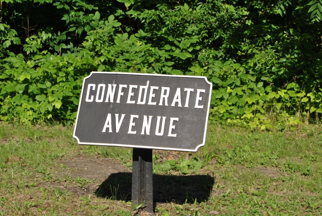
Confederate Avenue Tablet.
Erected: 1896.
Location: Six tablets constructed by War Department to mark East, West, North & South Confederate Avenues. Located at intersections and midpoints of North, South, East, West Confederate Avenues.
West Confederate Avenue (also known as Confederate Avenue Sections 1, 2, 3, and 4), constructed in 1894, follows to large extent breastworks occupied by Pender’s Division, Pengram’s Battalion & Kershaw’s Brigade. It runs in the north/south direction from Chambersburg Pike to Emmitsburg Road. Altered in 1950 and 1961.
East Confederate Avenue, constructed in 1899 and altered in 1934, was constructed by the War Department to provide access to park property & monuments associated with Confederate positions & movements during battle at Culp’s Hill. Connects Gettysburg Borough & former CSA positions on Middle Street to Slocum Avenue with a carriage turn-around at Spangler’s Spring.
North Confederate Avenue, constructed in 1902 and altered in 1935, runs from Buford Avenue & Mummasburg Road, to Doubleday Avenue & Mummasburg Road. Alignment was drastically changed to accommodate Peace Light Memorial development by NPS.
South Confederate Avenue (also known as Confederate Avenue Sections 5, 6, and 7), was construed in 1894 and altered in 1935. It runs through area where CS troops advanced to attack Round Tops on July 2 & crosses breastworks occupied by Law’s CS Brigade on July 3. Also extends through area where Farnsworth’s US Cav charged July 3. This was the first section of avenue opened that included Confederate positions. Runs from Emmitsburg Road to Warren & Sykes Avenues. Various realignments in 1930s made to accommodate automotive traffic, leaving road base in place as archeological site in several places.
Description: Cast iron avenue tablet designed by E.B. Cope. Mounted on fluted post, overall height is three feet.
